What could possibly cleave the continent more than the Grand Canyon? In many places it’s a barrier that can’t be crossed except by flight.
It’s a prominent river until Yuma, AZ, which is not too far from the Gulf of California. And even if the water doesn’t always flow, it forms the boundary between the Mexican states of Baja and Sonora.
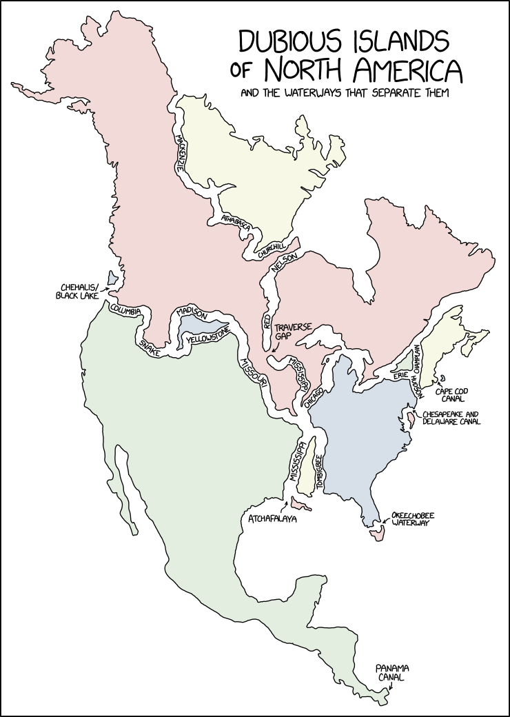
Yes, but you fail to understand the difference between a peninsula and a psuedo-island (a piece of land entirely surrounded by any body of water, artificial or manmade).
The Colorado River starts in Colorado is does not flow over the continental divide.
No river can be traced all the way up to a dividing ridge. As the contributing drainage area gets smaller it will be a stream, then creek, trickle, gulley, and by the time it’s on a mountain ridge it’s nothing.
You would think so, but there is one river that happens to flow and split over the continental divide called North Two Ocean Creek. It’s the tiniest technicality that makes this map technically true.
Running for office in Minnesota on the single-issue platform ‘dig a permanent channel through the Traverse Gap because it will make this map more satisfying.’
Fun fact, that traverse gap separates the red river of the north from the MINNESOTA river - which eventually drains into the Mississippi. The Mississippi starts at Lake Itasca.
Fun fact #2, the Minnesota/Mississippi drains into the Atlantic via the Gulf, but the red river eventually drains into the Arctic Ocean via the Hudson Bay!
Another fun fact; the Red River is very prone to spring flooding because it flows such a great distance north. The headwaters thaw out and start flowing while the river's outlet is still frozen over. Many cities and towns in Manitoba have dikes around them and turn into islands during the spring flood. Winnipeg has a flood diversion canal to guide the floodwaters past it each spring.
I think I just ran out of fun facts about Manitoba.


Add comment